25 Best Easy Hikes in Banff Canada with Stunning Views!
Hiking in Banff National Park is a must-do for nature lovers. With over 1,600 kilometers of trails, you can explore the diverse landscapes of the Canadian Rockies ranging from serene alpine meadows to rugged mountain peaks. Luckily there are plenty of easy hikes in Banff, making the trails accessible for all skill levels. From lakeshore walks to easy, moderate hikes up in the mountains, there is something for everyone’s taste and fitness level. Find in our complete guide the 25 best easy hikes in Banff with all the information you need!
25 BEST EASY HIKES IN BANFF
Castle Mountain Lookout hike
The Castle Mountain Lookout trail is a fantastic moderately short and easy hike near Banff with panoramic views of the Bow Valley and Rocky Mountains. It’s not the shortest or easiest hike in Banff as it’s a 7.4 km (4.6 miles) return with an elevation gain of 567 meters (1,794 feet). But therefore it feels like a nice workout with great views that doesn’t cost you all day.


The trail is easy to follow and although it is an uphill climb, there are no technical parts. Only a few of the steeper sections near the top require you to navigate some rocks. With 180-degree views once you break the treeline, the Castle Mountain Lookout Hike is well worth it!
Distance: 7.4 km (4.6 miles)
Elevation gain: 567 meters (1,794 feet)
Time needed: Around 3 hours
Read in our complete guide everything about Castle Mountain Hike

Johnston Canyon
Johnston Canyon Trail is one of the most unique and easy hikes in Banff National Park. You’ll walk across a well-maintained steel walkway suspended over Johnston Creek below through a limestone canyon, with scenic views of the Johnston Canyon falls and turquoise pools.

It’s one of the best family friendly hikes in Banff along the well-maintained trail that passes towering limestone canyon walls which is truly impressive. In the summer months, which is peak season, the Johnston Canyon Trail can be super busy. So the best time to plan this hike is either early morning or late afternoon. In the shoulder season and off-season, the trail is much quieter.
The great thing is that you can make Johnston Canyon hike as short or long as you want. Either walk until the spectacular 30-meter-high Johnston Canyon Upper Falls with 5.3 km (3.3 miles) in length, or only visit the Johnston Canyon Lower Falls at 1.1 km (0.7 miles) in length. And if you prefer to hike even longer, you can extend the trail from Johnston Upper Falls to the Ink Pots, making it a total 11.3 km (7 miles) hike.


Yearly road closures on the Bow Valley Parkway
Note that there are seasonal road closures on the Bow Valley Parkway where Johnston Canyon trailhead is located. Between May 1 to June 25 2024, and from September 1- October 1 2024 vehicles are restricted every day from 8 am to 8 pm on the Bow Valley Parkway between the Fireside Day-use Area and Johnston Canyon. The only way to reach Johnston Canyon parking area during this period by car is via the Castle Junction exit off the Trans-Canada Highway. Another option is to go by bicycle.
Distance: 1.1 km (0.7 miles) to the Lower Falls. 5.3 km (3.3 miles)to the Upper Falls.
Elevation gain: 105 meters (344 ft) to the Lower Falls. 273 meters (898 ft) to the Upper Falls.
Time needed: Round-trip to Johnston Lower Falls takes about 1.5 to 2 hours. Hiking to Johnston Upper Falls takes about 3 hours round trip on a slow pace.
Read in our complete guide everything about the Johnston Canyon Trail
Vista Lake Trail
Vista Lake is one of the shortest and easiest hikes in Banff National Park, but with a huge reward! The trail starts along the Banff-Windermere Highway at the edge of Banff National Park and the Continental Divide. It is the last hike in Banff before you cross the border to Kootenay National Park. The 2.7 km (1.7 miles) out-and-back trail to Vista Lake is part of the longer Arnica Lake Trail 10.2 km (6.3 miles).
The short trail takes you to the shore of Vista Lake with crystal clear green water. The perfectly positioned peak of Boom Mountain as a backdrop makes it a picture-perfect location.

Vista Lake is a great way to get away from the crowds in Banff as it’s not an overrun Banff hike. And the short distance with little elevation gain makes it a family-friendly and easy walk in Banff, even for young children. The small parking lot might fill up quickly though, especially because of the other hikes that also start from this point. Don’t park your car along the busy road due to safety reasons!
Distance: 2.7 km (1.7 miles) out-and-back
Elevation gain: 165 meters (541 ft)
Time needed: An hour or less
Read in our complete guide everything about Vista Lake Trail

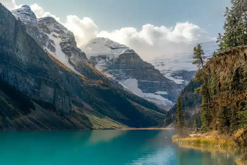
Moraine Lake Rockpile
The absolute best view of Moraine Lake is from the rock pile. This elevated view takes you along a staircase up the rocks with breathtaking views over Moraine Lake. While it’s just a short walk, the view is outstanding and much better than from the lakeshore.

Come for sunrise for a more tranquil experience than later during the day. You can also walk along Moraine Lakeshore for a different perspective of the lake.
Distance: 0.8 km (0.5 mile)
Elevation gain: 7 meters (23ft)
Time needed: 15 minutes up and down, but stay as long as you like

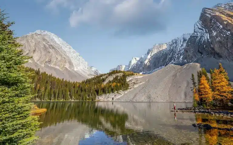
Consolation Lakes Trail
The Consolation Lakes trail is another Moraine Lake hike and follows a varied trail to the alpine lakes at the end. From here, you’ll have stunning views of the backside of the Ten Peaks, the tower of Mount Babel, and Mount Fay, crowned by glaciers.
Distance: 5.8 km (3.6 miles)
Elevation gain: 65 meters (213 ft)
Time needed: 1 – 2 hours

Fenland Trail with views of Vermillion Lakes
Located just outside the town of Banff is this short and scenic loop around the Vermilion Lakes. The easy stroll goes through the forest along Echo Creek and has stunning views of Mount Norquay while you make your way along the Vermilion Lakes and Bow River. While it’s not much of a hike, this short and flat trail does offer views of the beautiful lakes and surrounding mountains.
Distance: 1.8 km (1.1 miles)
Elevation gain: Nihil
Time needed: About an hour

Lake Louise Lakeshore Trail
This simple but stunning short hike takes you along Lake Louise lakeshore. It’s one of the easiest and best hikes in Banff with a huge reward. You’ll have breathtaking views all along the trail.

It’s a must to do at least a part of this trail when visiting Lake Louise. You will escape the crowds that accumulate in front of the Fairmont Hotel to take their pictures.

This is also the first part of the Plain of the Six Glaciers trail. So if you plan on doing that hike as well, you know you will pass Lake Louise shore first.
Distance: 4.5 km (2.8 miles)
Elevation gain: 36 meter (121 ft)
Time needed: 1 hour, or shorter, depending on where you turn around
Larch Valley
Larch Valley hike is one of the most beautiful hikes in Banff National Park. Located in the valley of the Ten Peaks surrounding Moraine Lake, Larch Valley is a breathtaking hike from start to finish.
Especially during the fall, Larch Valley becomes a magical destination. The breathtaking golden autumn colors of the larch trees are such a beautiful contrast with the white snow-capped mountains. It feels as if you’re walking in a real-life fairytale! I realize we had fantastic circumstances on a bluebird autumn day with fresh snow and golden larches. But Larch Valley easily became one of our favorite easy hikes in Banff.

Although it does feel more like a real hike and not an easy walk in the park, hiking Larch Valley is totally worth it. But make sure to depart early because especially during the fall, this easy Banff hike is very popular.
Distance: 8.6 kilometers(5.3 miles)
Elevation gain: 500 meters (1640 ft)
Time needed: 3 – 4 hours
Read in our complete guide everything about Larch Valley

Lake Agnes
Lake Agnes hike is a classic Lake Louise hike and one of the best hiking trails in this area. The moderately easy hike takes you up the mountain to Lake Agnes where the historic Lake Agnes Tea House is situated along the same named alpine lake. Lake Agnes hike can’t be missed on your Banff itinerary, however, the hike can feel crowded, especially in peak season.
If you have enough energy left, keep hiking to Little Beehive which is a stunning viewpoint on Lake Louise and the surrounding mountains.
Distance: 7.6 km (4.7 miles)
Elevation gain: 433 meters (1420 ft)
Time needed: 2-4 hours

Plain of the Six Glaciers Trail
The Plain of the Six Glaciers Trail takes you deep into the valley behind Lake Louise to a spectacular viewpoint overlooking six hanging glaciers. This view can be reached after 7 km one way, and along the trail you will also pass the iconic Plain of Six Glaciers tea house.

It’s one of the best Banff hikes which is not the easiest, but also not a crazy difficult climb. However, the views of the six glaciers and surrounding mountain peaks is otherworldly. You’re standing in an amphitheater surrounded by glaciers and snow-capped peaks which gives the true Canadian Rockies feeling. Where else can you get this kind of view after only 7 km of hiking?

The hike does combine the Lake Louise Lakeshore Trail. So if you’re planning to do that easy walk as well and you have time left, then I highly recommend the Plain of the Six Glaciers trail. Make sure to walk until the end, called the Abbot Pass viewpoint for the very best views.
Distance: 11 km (6.8 miles) return to Plain of Six Glaciers tea house. 14 km (8.6 miles) return to Abbot Pass viewpoint (the best view of the glaciers!).
Elevation gain: 420m (1377 ft) to the tea house and 520m (1706 ft) toAbbot Pass viewpoint.
Time needed: Around 5 hours.
Read in our complete guide everything about the Plain of the Six Glaciers Trail

Fairview Lookout Trail
Fairview Lookout trail is one of the shorter hikes around Lake Louise. From the lookout, you’ll have stunning elevated views over Lake Louise and the Fairmont Hotel. The hike to the viewing platform is all through the forest, so the only view you’ll get is at the end of the short hike. It’s an easy trail for young children or those who are less mobile.
Distance: 2 km (1.2 miles)
Elevation gain: 100 meters (328 ft)
Time needed: 1 hour

Parker Ridge Trail
The Parker Ridge Trail takes you over a well-maintained path to the mountain ridge with spectacular views over the Saskatchewan Glacier and surrounding mountains. It’s a great easy Banff Hike with an amazing reward for minimal effort.
Located along the Icefields Parkway, Parker Ridge Trail is a fantastic option to stretch your legs while driving this scenic road. You do need clear weather to see most of the glacier though.

Distance: 5.1 km (3.1 miles)
Elevation gain: 270 meters (885 ft)
Time needed: 2-3 hours
Read in our complete guide everything about Parker Ridge Trail

Peyto Lake Lookout
Peyto Lake is a stunning glacial-fed lake with a spectacular mountain backdrop located along the Icefields Parkway in Banff National Park. A short and easy walk of about 10 – 20 minutes over a paved trail takes you to the main viewpoint of Peyto Lake. From here you’ll have panoramic views over Peyto Lake with its vibrant turquoise color and the shape of a wolf’s head. It’s an incredibly huge reward for such a short walk that is even wheelchair accessible! Therefore it’s one of the easiest hikes in Banff, but a must-do.
Distance: 0.5 km (0.3 miles) to the main viewpoint
Elevation gain: 92 meters (305 feet)
Time needed: 30 – 60 minutes
Read in our complete guide everything about Peyto Lake

Toe of the Athabasca Glacier
Walking the short trail to the toe of the Athabasca Glacier allows you to stand right in front of a huge glacier! It’s one of the easiest and best ways in the Canadian Rockies to stand this close to a glacier. Quite unique and impressive! The short trail along a gravel path takes you to a wide area with unobstructed views of the glacier. You can walk it as a loop or go the same way back to the car park.
Along the trail are plenty of interpretive signs with information about the glacier and how much it has retreated over time.
Distance: 1.4 km (0.8 mile)
Elevation gain: 61 meters (200 ft)
Time needed: 1 hour or less

Bow Summit
Bow Summit hike is a longer hike at Peyto Lake, offering a slightly different perspective of the lake. It is a great way to escape the crowds at the first main viewpoint of Peyto Lake. And if you plan to take some nice photos at Peyto Lake with yourself in the frame, then Bow Summit offers some great options with a natural foreground of rocks.
Distance: 6.6 km (4 miles)
Elevation gain: 280 meters (918 ft)
Time needed: 2 hours

Sunshine Meadows
The Sunshine Meadows trail is a beautiful moderate hike near Banff situated in a stunning alpine meadow. You have to take the Sunshine Village Gondola up to the village from where you’ll start the hike. The gondola only operates for hikers from June 21 to September 8, 2024, daily from 8 AM – 6 PM (the last gondola down is 6 pm). During the winter months, Sunshine Village changes into one of the most popular ski resorts in Banff. The Sunshine gondola & chairlift pass costs $65 CAD per person.
There are a few beautiful hikes to do in Sunshine Village, but the Rock Isle Lake is the most popular and rewarding hike. You will follow the shoreline of two alpine lakes, cross a larch forest, and you’ll get spectacular views to Kootenay National Park.
Distance: 8 km (5 miles)
Elevation gain: 309 meters (1014 ft)
Time needed: 2-4 hours

Tunnel Mountain Trail
Tunnel Mountain is one of the easy hiking trails in Banff and is easily accessible from downtown Banff. You can hike Tunnel Mountain year-round, and while it is one of the smaller mountains in Banff National Park, the views along the trail of the surrounding valleys, mountain peaks and Mount Rundle at the summit are truly spectacular!
Distance: 4.5 km (2.8 miles)
Elevation gain: 266 meters (873 ft)
Time needed: 1-2 hours


Sulphur Mountain with the Banff Gondola
In Banff you can get to the top of a mountain without the effort of actually climbing it! With the Banff Gondola you can get to the top of Sulphur Mountain where a short 1 km boardwalk takes you along the ridge with sweeping views of Banff townsite and beyond.
If you want to get a workout in you can also hike to the top of Sulphur Mountain in Banff. It does save you $55 CAD per adult for the Gondola Pass, however the 10.7 km (6.7 miles) with 755 meters (2477 ft) elevation gain is not particularly an easy hike anymore. But the boardwalk at the top of Sulphur Mountain is only 1 km with just 35 meters incline.
Distance: 1 km
Elevation gain: 35 meters
Time needed: 1 hour if you take the gondola up

Grassi Lakes
Although this easy hike isn’t technically in Banff National Park anymore, I wanted to share it on this list. It’s only a 30-minute short drive from downtown Banff to get to Grassi Lakes trailhead which is located in the beautiful town of Canmore. The same distance as you would drive to Lake Louise or Castle Mountain trailhead from Banff.
Grassi Lakes trail takes you along the crystal clear lakes with Ha Ling as a backdrop. It’s a very family friendly hike and doesn’t take all day to complete. A great short hike in Canmore that you can perfectly combine on a day trip from Banff.
Distance: 4.3 km (2.7 miles)
Elevation gain: 203 meters (666 ft)
Time needed: 1-2 hours

Sundance Canyon trail
The beautiful Sundance Canyon trail is a fun hike that follows the Bow River for the most part, making it a flat trail with only some elevation gain at the end toward the canyon.
The trail starts at the Cave and Basin National Historic Site parking lot where you can choose between the various boardwalks or the marsh loop. You don’t even have to complete this full hike for the best views, as you will have plenty of stunning mountain views along the trail. However, if you want to hike to the Sundance Canyon, then be prepared for some elevation gain at the end.
Distance: 9.5 km (6 miles)
Elevation gain: 389 meters (1276 ft)
Time needed: 2 hours

Bow Falls
The Bow Falls walk is easily accessible from Banff downtown and is a great place for an easy stroll along the Bow River. The Bow Falls viewpoint is reached at 1.5 km from the Banff center, so it’s just an easy walk to stretch the legs. Along the way you’ll have stunning views of the Bow Valley and surrounding mountains.
Distance: 3 km (1.8 miles)
Elevation gain: 50 meters (164 ft)
Time needed: 1 hour

Johnson Lake Loop
Johnson Lake hike is a relaxing stroll along the lake with stunning mountain scenery. With no elevation gain, it is a lovely short hike near Banff and a perfect hike for families.
Distance: 3.1 km (1.9 miles)
Elevation gain: Nihil
Time needed: 1 hour

Two Jack Lake Trail
Two Jack Lake is one of the beautiful lakes in Banff with scenic views of the iconic Mount Rundle. On a calm day, the mountain reflects in the lake, offering stunning photography opportunities.
There are plenty of activities to do along Two Jack Lake including walking, paddle boarding, kayaking, and there is a lovely picnic area as well. Without a doubt a perfect place to spend a sunny day in Banff!
Distance: 4.8 km (3 miles)
Elevation gain: 87 meters (285 ft)
Time needed: 1 – 2 hours

Silverton Falls
The Silverton Falls trail is part of the more advanced and long hike to Rockbound Lake. But for a short Banff waterfall visit, you can hike along the old dirt road following along Silverton Creek until Silverton Falls viewpoint. The 50-meter tall waterfall is especially impressive in late spring and the summer months when snow melts creates an extra powerful stream.
Distance: 1.8 km (1.1 miles)
Elevation gain: 112 meters (367 ft)
Time needed: 1 hour

How to get a National Park Pass?
To enter Banff National Park you need a Parks Canada Pass. Depending on the number of days you plan to visit the Canadian National Parks, you can either buy single daily admission tickets or the Parks Canada Discovery Pass which is a multi-park entry pass for 365 days. You can purchase the different Parks Canada Passes online at the Parks Canada website, at the National Park Visitor Centres or at booths upon entering the many national parks. See all the options and prices below.
Single daily admission pass
This entrance fee ticket is sold per person, per day, per National Park. It is only the best option if you are solo traveling and just visiting one or two national parks for a couple of days.
- $10.50 CAD for an adult (from 18-64 years)
- $9.00 CAD for Senior (65+)
- FREE entrance for kids younger than 17 years
Group daily admission pass
For the ones traveling with 2 or more people in one car, you can buy a single-day group admission pass. This pass gives entrance for up to 7 people in one vehicle.
- $21.00 CAD for one vehicle entry for one full day (maximum 7 people)
Parks Canada Discovery Pass
The “Discovery Pass” is the best option for travelers who plan to visit multiple National Parks. Basically, if you’re spending more than 7 days in the Canadian National Parks, you’ll have a much better deal buying the Discovery Pass. This multi-park entry pass is valid for 365 days to access all participating national parks in Canada. These include Jasper, Banff, Yoho, Kootenay, Glacier, Mount Revelstoke, and much more.
- $72.25 CAD for one Adult (age 18-64)
- $61.75 CAD for one Senior (64+)
- $145.25 CAD for a couple or group/family up to 7 people in one vehicle
FAQ about hiking in Banff
Is Banff good for beginner hikers?
Yes, Banff National Park has some amazing beginner hikes that are relatively flat and short in distance but with breathtaking views. I think that is always the huge advantage of hiking in a mountainous area, where you can just walk along the lakeshore but still see the impressive surrounding mountains.
All the easy hikes in Banff are well-marked, well-maintained and with little to no elevation gain. It allows people of every skill level to explore picturesque landscapes without extensive experience or technical skills. Additionally, several short, interpretive trails cater specifically to beginners, offering informative signage and gentle terrain.
What is the easiest mountain to hike in Banff?
Tunnel Mountain, also known as Sleeping Buffalo because it resembles a sleeping buffalo from the north, is the easiest and most accessible mountain to hike in Banff. You can reach the trailhead from downtown Banff and the trail is accessible year round. This easy 4.5 km (2.8 miles) hike with 266 meters incline offers stunning views of Banff town, the surrounding valleys, mountain peaks and Mount Rundle at the summit.
Is Moraine Lake an easy hike?
Yes, the walk along Moraine Lakeshore is a flat, easy trail and suitable for everyone.
What is the easiest hike in Banff?
The Fenland Trail is often referred to as one of the easiest hikes in Banff National Park. This flat, looped trail offers a gentle stroll through a peaceful forested area along the Bow River. It’s wheelchair accessible and suitable for all skill levels, including families with children and beginner hikers. The trailhead is conveniently located near the town of Banff, making it easily accessible for visitors looking for a relaxed outdoor experience without venturing too far from amenities.
Is it safe to hike in Banff?
Yes, hiking in Banff National Park is generally safe, but it’s essential to be prepared and aware of potential risks. Here is an overview of the things you need to prepare or be aware of.
- Wearing the right hiking shoes with enough grip for rough terrain
- Be aware of wildlife encounters. Banff is home to bears, cougars, and other wildlife. Carry bear spray, make noise while hiking, and stay alert. Familiarize yourself with wildlife safety protocols. More about that in the next paragraph.
- Be prepared and mindful of weather changes
- Download offline maps from AllTrails so you can navigate the trail route
- Bring plenty of water and high-energy snacks to stay hydrated and fueled during your hike.
Wildlife in Banff National Park
If you’re like us, visiting Canada as a traveler and outdoor lover, you might be new to bear country. Please be aware that Banff is prime grizzly territory. This is not to scare you but to make you very aware of the wildlife that can be around. There are frequent sightings of black bears, grizzly bears, moose, coyotes, and cougars in this region.
While these wild animals are mostly in a calm state of mind, they will feel easily threatened by humans in case they have offspring around. Or when a human comes too close, either to their food source or accidentally startles the animal. Therefore you should be very aware of your surroundings during the hike and make noise so an animal can hear you coming.
Makes sure to always carry bear spray on Banff hikes and educate yourself about bear encounters. Grizzly bears and Black bears are different kinds of animals, they need a different approach in case of an encounter. Please be bear aware and do your research!

More Canada travel inspiration
I hope you enjoyed this complete guide about the best easy hikes in Banff National Park. For more travel inspiration about British Columbia and Alberta, head over to our other Canada travel guides. See below our Canada guides per National Park to prepare for your trip.
Read here our incredibly extensive guide about RVing in Canada
Banff National Park
Peyto Lake Visitors Guide – All You Need to Know
Castle Mountain Lookout Trail Hiking Guide
Parker Ridge Trail – Complete Hiking Guide
Plain of the Six Glaciers Trail – Complete Hiking Guide
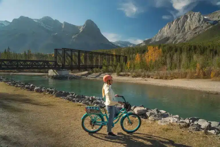
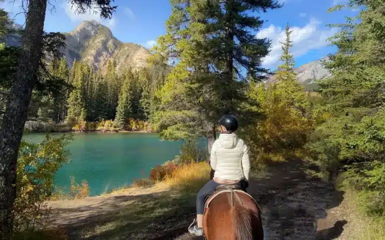
Horse riding experience in Banff National Park
Jasper National Park
Mount Edith Cavell hike – The Complete Guide
Kootenay National Park
Floe Lake hike – Complete Guide
Kananaskis
Chester Lake hike – Complete Guide
Smutwood Peak hike – Complete Guide
East End of the Rundle hike – Complete Guide
British Columbia
How to hike the epic Panorama Ridge in Garibaldi Provincial Park
Joffre Lakes hike – Complete Hiking Guide
St Marks Summit hike Vancouver
The best Whale Watching tours in Vancouver
Stunning Helmcken Falls in Wells Gray Park
Did you find this post useful? Save THIS PIN to your Pinterest board on Pinterest to read it later again.


This post may contain affiliate links
We hope this guide will help you plan your travels! If you consider booking your accommodation, tours or rental car via our affiliate links, you support this blog because we earn a small commission at no additional cost to you!