THE 20 BEST HIKES SOUTH ISLAND NEW ZEALAND
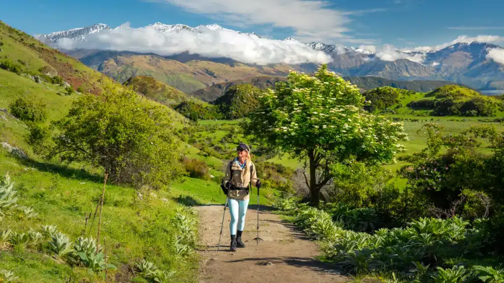
The South Island of New Zealand is a paradise for hikers. With its stunning variety of landscapes within a relatively small area, well-maintained trails that are easily accessible, and no danger of wild or dangerous animals, New Zealand is one of the safest and best countries in the world for hiking. From most of the cities and towns on the South Island, you have direct access to lush rainforests, towering mountains, glacial valleys, serene lakes and alpine meadows. In this complete guide, you’ll find the 20 best day hikes on the South Island of New Zealand. We did all the hikes ourselves so we can honestly advise which ones are the best South Island hikes. All hikes are divided per area or National Park so you know from which town you can plan them.
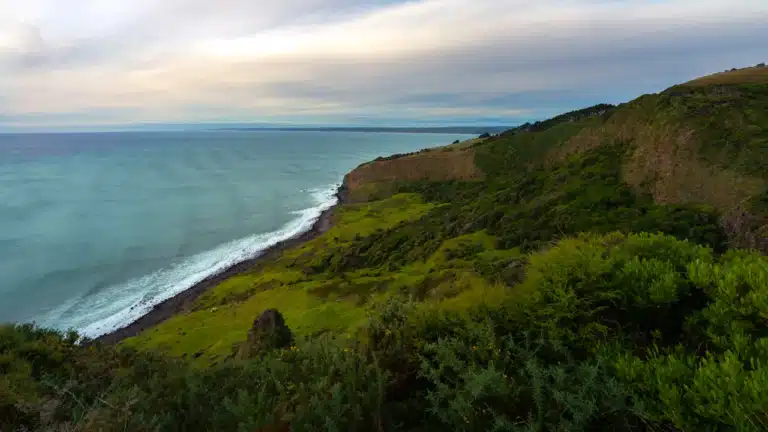
Fiordland National Park
Located on the southwestern corner of the South Island, Fiordland National Park is well known for Milford Sound and the stunning cruises you can do. The park encompasses a diverse range of beautiful landscapes, including fjords, rainforests, lakes, and mountains. The nearest major town and gateway to Fiordland National Park is Te Anau. Situated on the shores of Lake Te Anau this little town is a great base to explore the many hikes in Fiordland National Park.
With its dramatic and diverse landscapes, Fiordland National Park has some of the best hikes on the South Island of New Zealand. These are our favorite day hikes in Fiordland National Park. But note that you can do the Milford Track and Kepler Track in Fiordland National Park as multi-day hikes which are not mentioned in this guide.

Gertrude Saddle Track
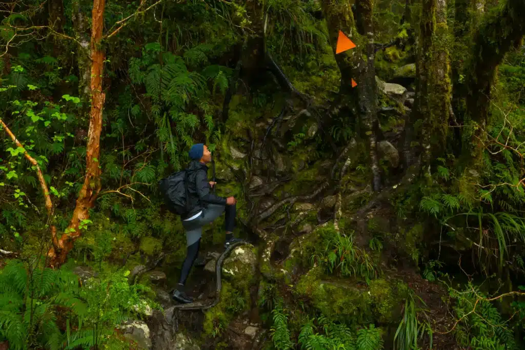
Gertrude Saddle track is some of our, if not THE, most favorite hike on the South Island of New Zealand. After a failed attempt in spring because of the bad weather, we tried again in autumn and were blessed with a stunning, clear day. Which is the most important for Gertrude Saddle hike. You can’t do this challenging hike in rainy weather because of the slippery rocky slabs. Gertrude Saddle hike involves steep ascents and exposed sections but rewards you with some of the most stunning alpine views overlooking Milford Sound.

This is not a hike for beginners as there are quite some technical sections along the trail that require good navigation skills. You need to be well prepared and only hike Gertrude Saddle in good weather. Rain can even be very dangerous on this hike. Especially on the rocky slab section which can become very slippery and resulted in fatal deaths in the past.

If you want to hike the Gertrude Saddle track, then make sure to be well prepared. Read our complete guide about Gertrude Saddle track to see the trail in our pictures and understand where the dangerous parts are.
Gertrude Saddle hike distance and duration: The return distance of Gertrude Saddle hike is 7 kilometres which takes 4 – 6 hours to complete.
Gertrude Saddle hike difficulty and incline: Gertrude Saddle hike is an expert route and should only be attempted in good weather. The incline is 646 meters with a very steep section at the rocky slabs. The hike starts pretty easy on a flat surface through the Gertrude Valley but turns sharply upwards once you get to the cliff you need to hike up.

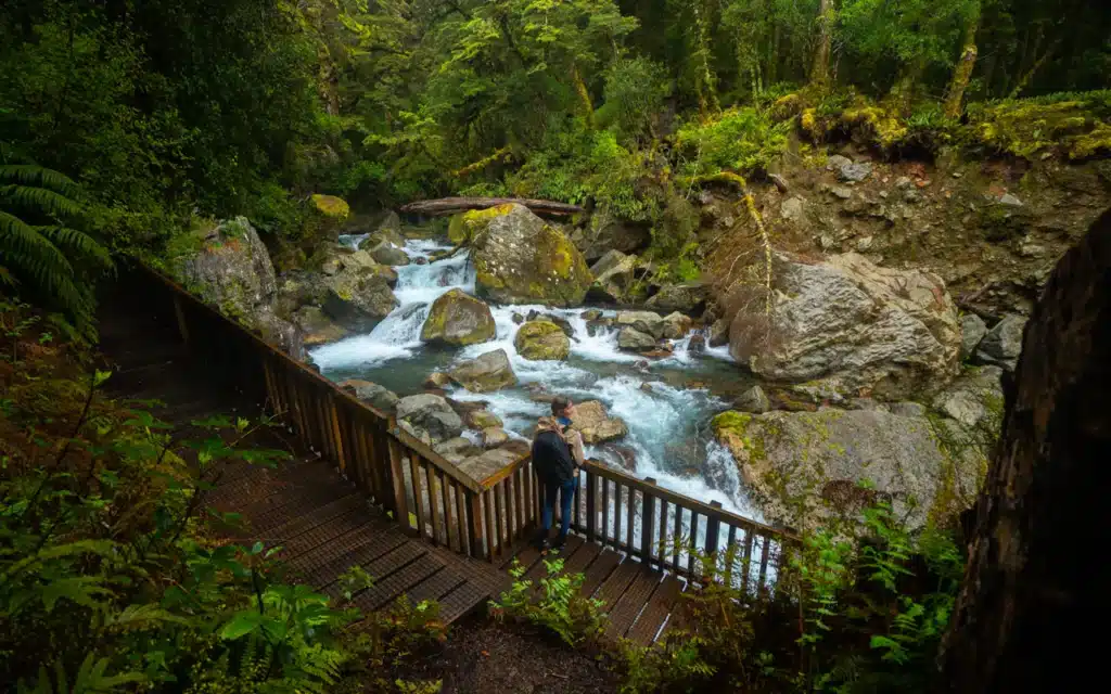
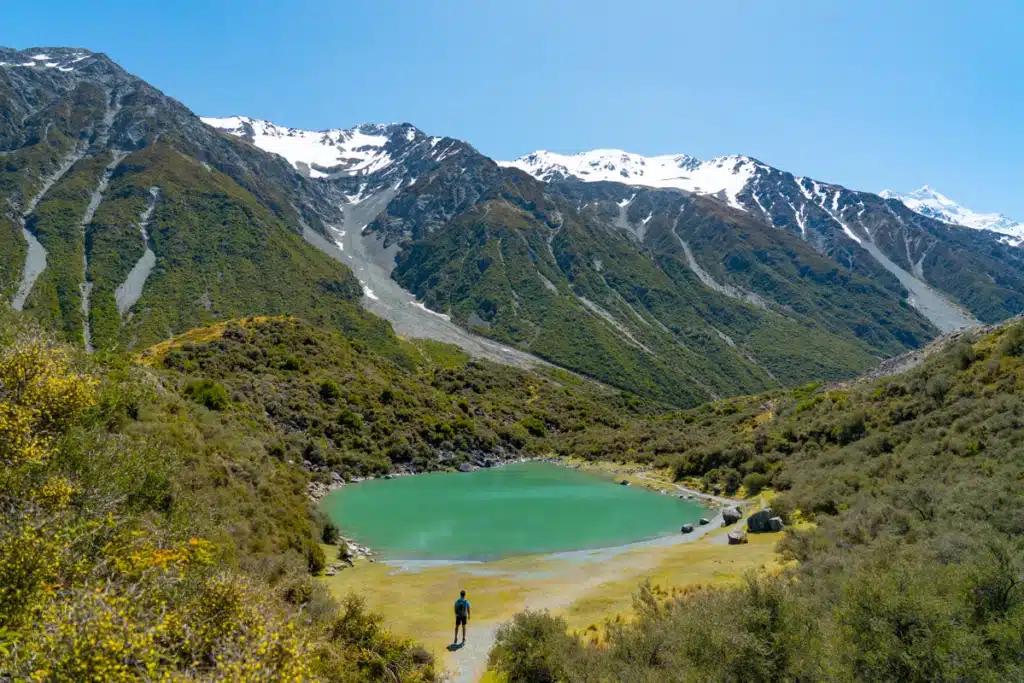
Lake Marian Track
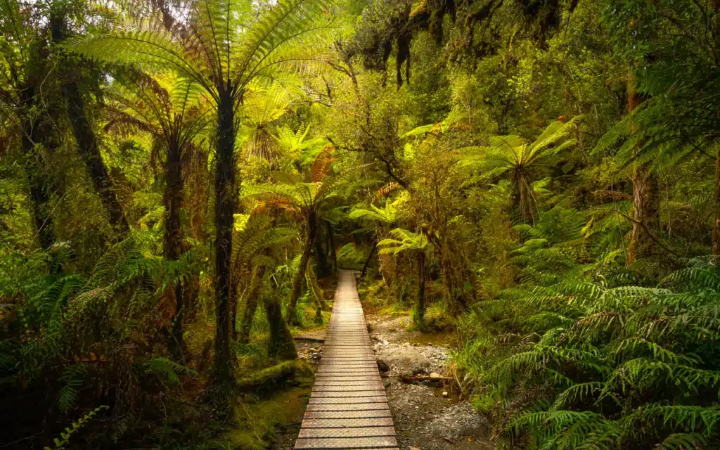
Lake Marian track is a stunning day hike through ancient mossy rainforest that brings you to a magical reflection lake. During the hike, you will encounter a variety of things such as a hanging bridge, a roaring river, and a stunning reflection lake in a valley surrounded by snow-capped mountain peaks and waterfalls.

Lake Marian Track is truly mesmerizing and some of the best day hikes you can do in Fiordland National Park. The variety that Lake Marian track has to offer is super interesting and well worth the 10 km out and back hike. It is without a doubt one of the must-do hikes on the South Island of New Zealand.
Read in our complete guide everything about Lake Marian Track
Lake Marian distance and duration: The total hike distance of Lake Marian track is 10 kilometers return. With some muddy patches and a bit of climbing up tree roots, it is definitely not a beginner hike and will take 4 hours to complete including time to enjoy Lake Marian.
Lake Marian track difficulty and incline: The elevation gain of Lake Marian track is a little more than 400 meters so it’s not too steep. However, there is a part where you have to climb a little part with tree roots. It’s nothing to worry about though as you can easily use your hands. Just make sure to wear proper hiking boots as you will need the grip along the trail.

Key Summit Track
The Key Summit track is one of the easier day walks in Fiordland National Park. Although 2/3 of the hike is a gradual incline through mossy forest, the loop at the tarns is flat and over a well-maintained boardwalk.
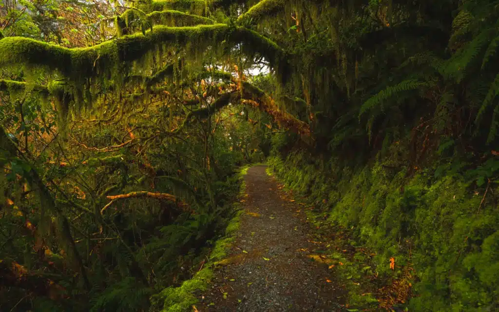
Key Summit Track is part of the Routeburn Track and takes you through an ancient mossy rainforest with a stunning view of the snowcapped Humbolt and Darran Mountains including alpine tarns at the end of the hike. Here you can explore this impressive alpine environment and learn more about how the landscape was formed.

Read in our complete guide everything about Key Summit Track
Hike distance and duration: Depending on how many sidewalks you take at the tarns, the total distance of Key Summit track is around 8 kilometers. It will take you about 3 hours to complete the whole hike including some time to take in the panoramic views of the lakes.

Difficulty and incline: The Key Summit track has about 450 meters in elevation gain and is a moderate route. It’s never too steep and the path is very easy to follow and well maintained. Once you’ve passed the treeline the gravel path changes in a wooden boardwalk that follows along the tarns. In the winter there could be some snow and ice near the tarns. So make sure to check the conditions with the DOC before departing.
Mount Cook National Park
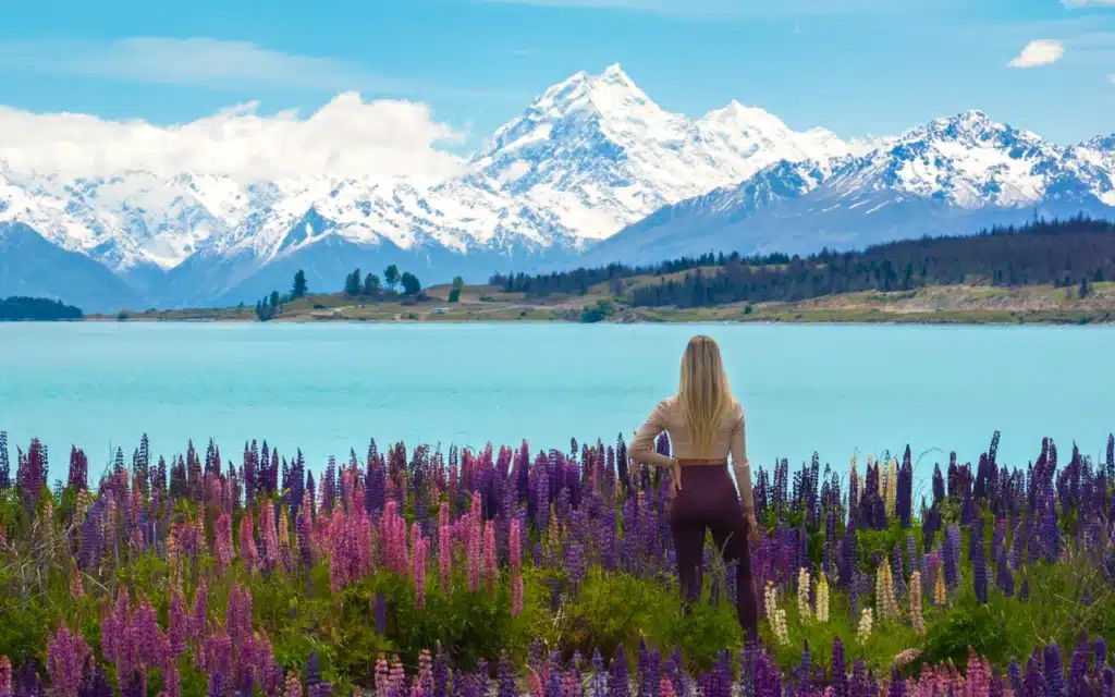
Mount Cook National Park is home to the beautiful Southern Alps, including New Zealand’s highest peak, Aoraki/Mount Cook. Hiking here provides breathtaking views of towering mountains, glaciers, alpine meadows, and turquoise lakes, creating a stunning backdrop for your outdoor adventures. Mount Cook National Park has some of the best hikes in the South Island of New Zealand, and the great thing is that those hikes aren’t the hardest!
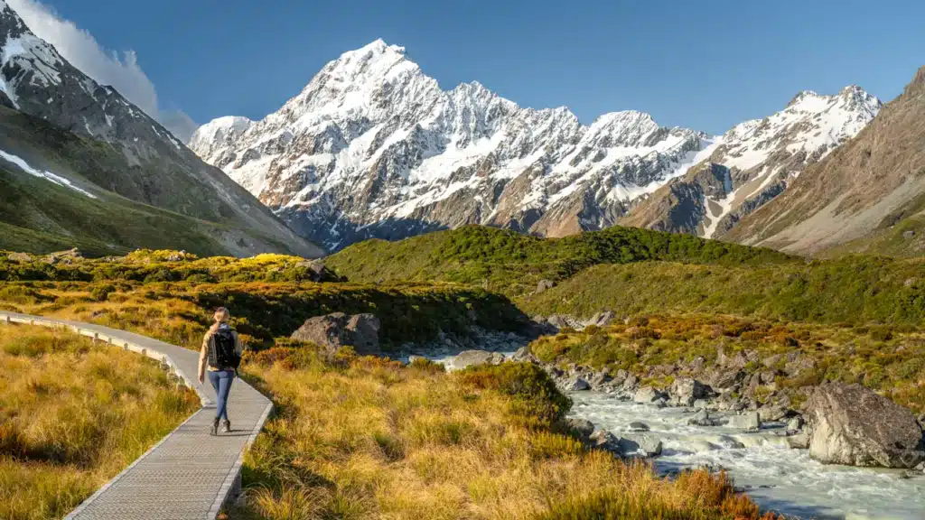
Hooker Valley Track
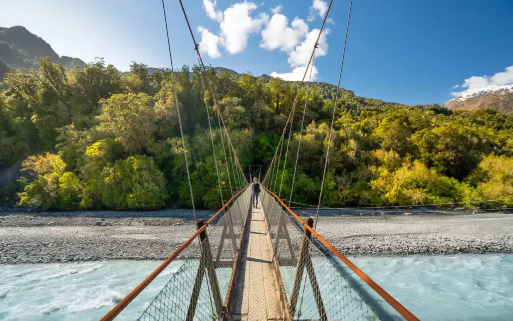
The Hooker Valley track is one of the most beautiful and famous hikes on the South Island of New Zealand. And the good news is, you don’t have to hike too far and there isn’t much incline. The Hooker Valley track is just a stunning, easy day hike in Mount Cook National Park along the Hooker River to Hooker Glacier Lake. Along the very well-maintained trail, you will cross suspension bridges, walk on a boardwalk and eventually get to Hooker Lake with mesmerizing views of Aoraki Mount Cook.
If you don’t have your own transportation, then I highly recommend booking this small guided group tour including pick-up from Queenstown. This fully-guided day trip combines all the key highlights of Mt Cook NP with the famous Hooker Valley Hike.
Hooker Valley track distance and duration: 5 kilometers (3.1 miles) each way so 10 kilometers in total. You will return via the same trail, but the views are beautiful whichever way you look. The total time that Hooker Valley Track will take is about 3.5 hours including some photo stops.
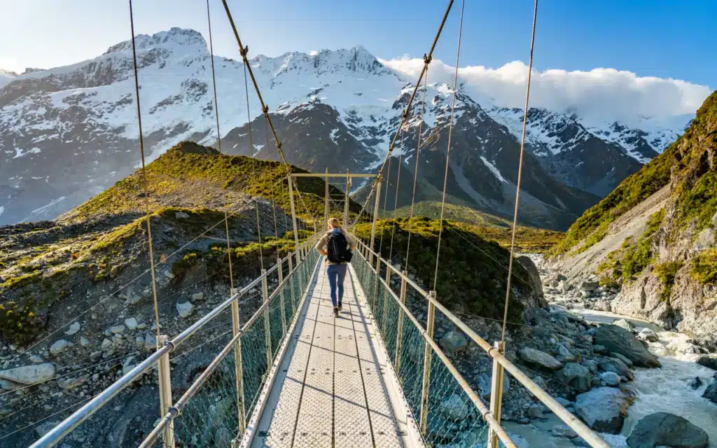
Hooker Valley track difficulty and incline: The whole trail of Hooker Valley is flat and very well maintained. Therefore I think it’s an easy hike which can be done by everyone. The trail goes partly over a gravel path, but also a wooden boardwalk and suspension bridges which take you over Hooker River.
Read in our complete guide everything about Hooker Valley Track
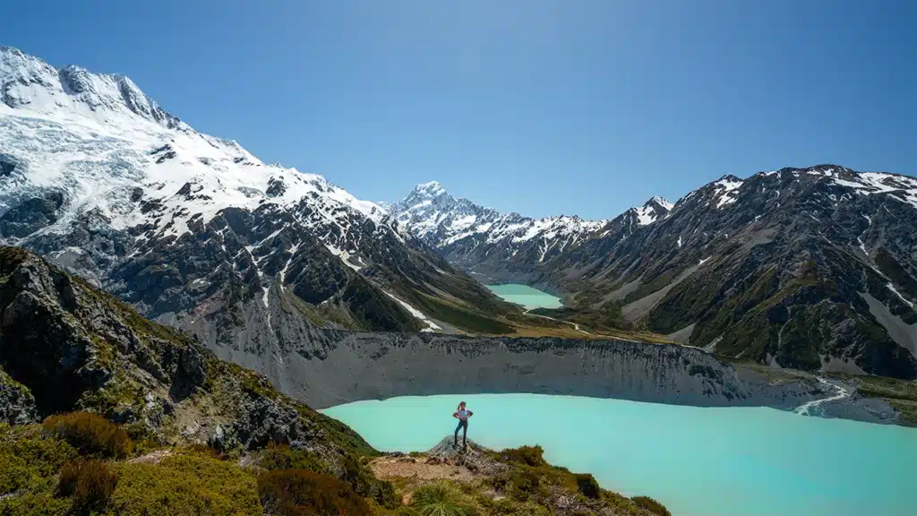
Sealy Tarns Track
The Sealy Tarns track is a beautiful hike up to a viewpoint overlooking the Hooker Valley, Mueller Lake, and surrounding snow-capped peaks including Mount Cook. It’s also known as the ‘Stairway to Heaven’ in New Zealand and you will soon understand why!
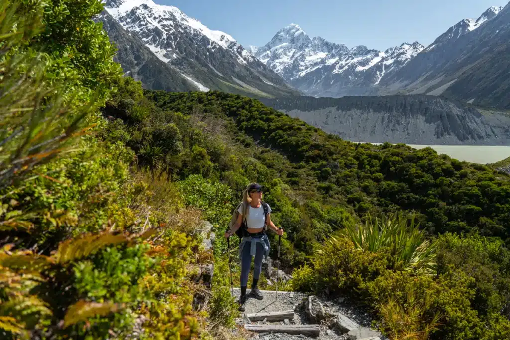
Although this hike isn’t the longest with only 5.8 kilometers round trip and 547 meters of elevation gain, you have to climb 2,200 steps. But the spectacular views are so worth it! The Sealy Tarns hike is also the first part of the Mueller Hut track, but if you don’t plan on hiking that far, then the views from Sealy Tarns lookout are worth the effort. With a picnic table and plenty of room to sit on the rocks, the Sealy Tarns Viewpoint is a perfect spot to enjoy your lunch.
Sealy Tarns Track distance and duration: The out and back distance of Sealy Tarns track is 5.8 kilometres which will take an average of 3 to 5 hours to complete. Of course this can be longer if you spend a long time at the viewpoint and picnic bench.
Sealy Tarns Track difficulty and incline: With 2,200 steps to climb over 600 meters (1,969ft) of elevation gain, the Sealy Tarns track is a fun challenge for the legs. The trail isn’t too technical, it’s just an unending amount of stairs! I would say the hike is moderately difficult, as the steps make it quite easy to navigate since there is no rocky, slippery ground to navigate. Of course, your fitness level depends on how easy or difficult the hike is going to be, but with the Sealy Tarns track you can literally take it step by step!
Read in our complete guide everything about Sealy Tarns Track
Mueller Hut Track
The Mueller Hut hike is one of the most beautiful Mount Cook National Park hikes. The track takes you up along the Sealy Range to the Mueller Hut which is located at an altitude of 1,800 meters (5,905 feet). Here you’ll have breathtaking views over Aoraki Mount Cook and the surrounding snow-capped peaks.
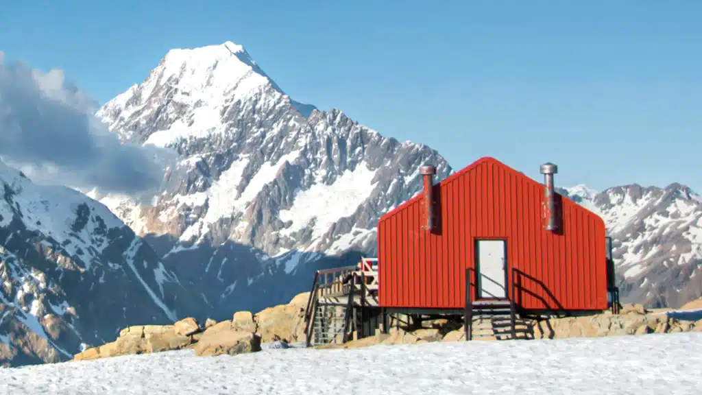
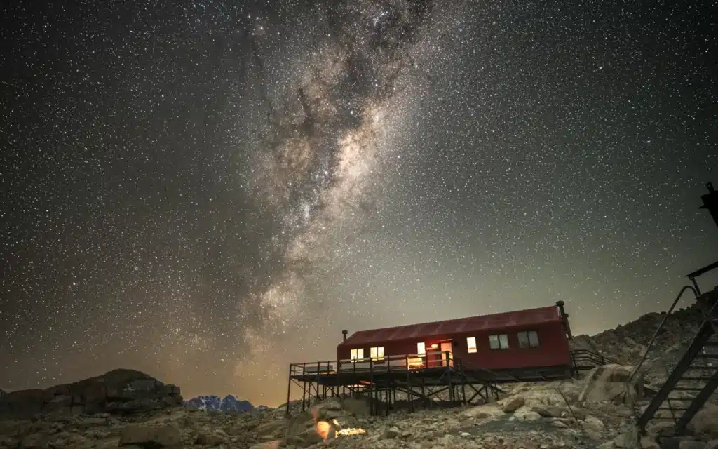
Although the Mueller hut hike isn’t the hardest in terms of distance, you will climb over 1000 meters of elevation in only 5 kilometers one way. Generally, the purpose of the Mueller Hut hike is to stay overnight in the DOC hut which you have to pre-book. But if you’re short in time and you’re a fit hiker, then the Mueller Hut hike is also manageable to complete on the same day. However, you will then miss out on sleeping under some of the darkest skies in the world!
Mueller Hut track distance and duration: The Mueller Hut track is 10.4 kilometers (6.5 miles) round trip, with an elevation gain of around 1,000 meters (3,280 feet). The estimated hiking time for the Mueller Hut track is around 3-4 hours to reach the hut, and around 2-3 hours to descend back to the trailhead.
Mueller Hut track difficulty and incline: The Mueller Hut track is a challenging hike due to its steep incline and rocky terrain. With an elevation gain of around 1,000 meters (3,280 feet) over a distance of approximately 5.2 kilometers (3.2 miles) you will feel your legs burning!
Read in our complete guide everything about the Mueller Hut hike
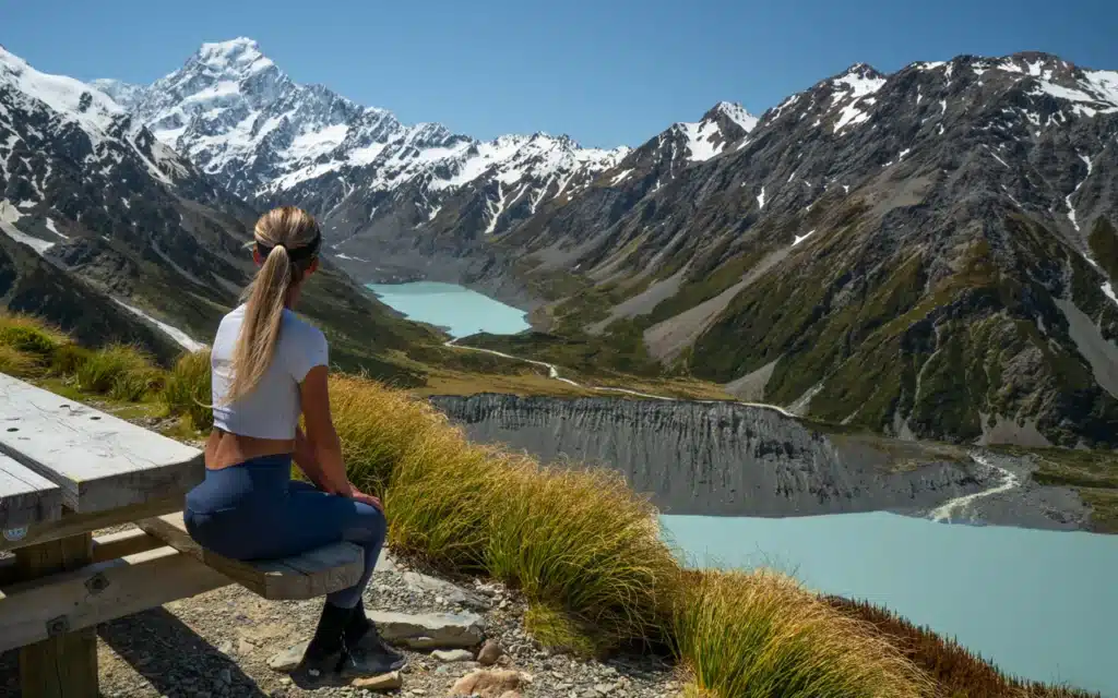
Tasman Glacier Lake Track
The Tasman Glacier Walk is the shortest and easiest walk in Mount Cook National Park. It offers stunning views of the Tasman Glacier and Tasman Lake, floating icebergs, and snow-capped mountains.
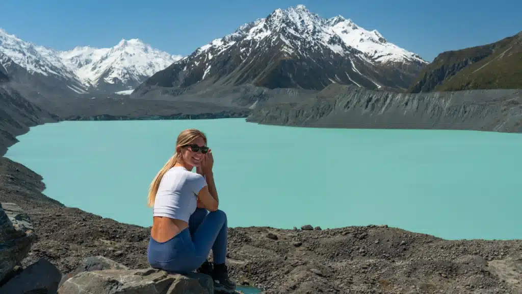
This hike is easy to do for everyone and can’t be missed on your New Zealand itinerary. And you can also combine it with a quick visit to the Blue Lakes. This is only a short few minutes extra. The combination of the stunning Blue Lakes and Tasman Glacier viewpoint gives you a great variety of things to see.
Tasman Glacier View walk time and distance: With only 1.8 kilometers (1.1 mi) return, the Tasman Glacier View track is a very easy walk that doesn’t take longer than 40 – 50 minutes to complete. Depending on how long you spend at the Blue Lakes and Tasman Glacier viewpoints.
Tasman Glacier view walk difficulty and incline: There are only a few stairs to climb over 85 meters (280 ft) elevation gain. So yes, there is a little incline but nothing too serious.
Read in our complete guide everything about the Tasman Glacier walk
Wanaka
Wanaka is located at the doorstep of Mount Aspiring National Park, nestled on the southern end of pristine Lake Wanaka and surrounded by the majestic Southern Alps. The combination of Wanaka’s convenient location, diverse hiking opportunities, amenities, and access to outdoor activities makes it an ideal base for exploring the beauty of Mount Aspiring National Park and the surrounding areas. Besides all the best things to do in Wanaka, there are also plenty of amazing places to stay in Wanaka!

Rob Roy Glacier Track
Located in Mount Aspiring National Park, the Rob Roy Glacier track is a 10-kilometer (6.2-mile) return hike that takes you to a dramatic alpine landscape that includes snowfields, glaciers, river valleys, and waterfalls.
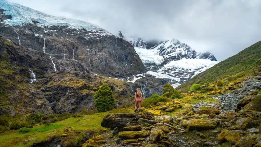
This breathtaking hike near Wanaka includes all the nature elements that is New Zealand in our opinion. Lush native beech forest, gushing waterfalls, crystal clear glacier rivers, sheer rock cliffs, dramatic alpine landscapes, and a hanging glacier. The Rob Roy Glacier trail is one of the most beautiful hikes on the South Island of New Zealand.

Rob Roy Glacier track distance and duration: The 10-kilometer (6.2-mile) return trip takes approximately 3-4 hours to complete. Depending on how long you spend at the different lookout points of course!
Rob Roy Glacier track difficulty and incline: The track is graded as intermediate, which means that it is suitable for people with a moderate level of fitness and hiking experience. You gain around 410 meters (1,345 feet) of elevation along the Rob Roy track.
Read in our complete guide everything about Rob Roy Glacier Track
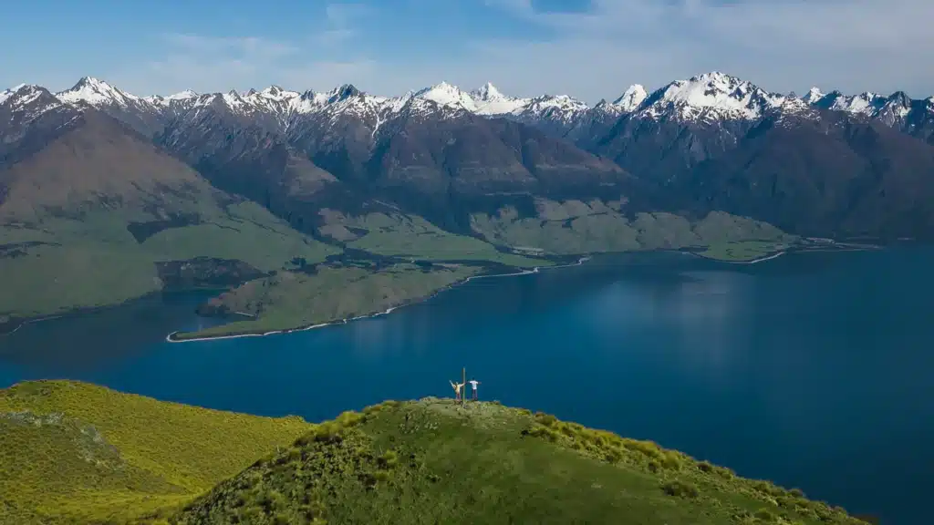
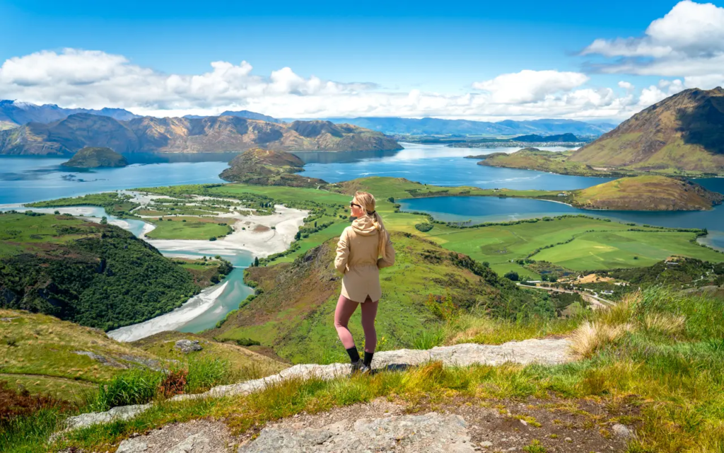
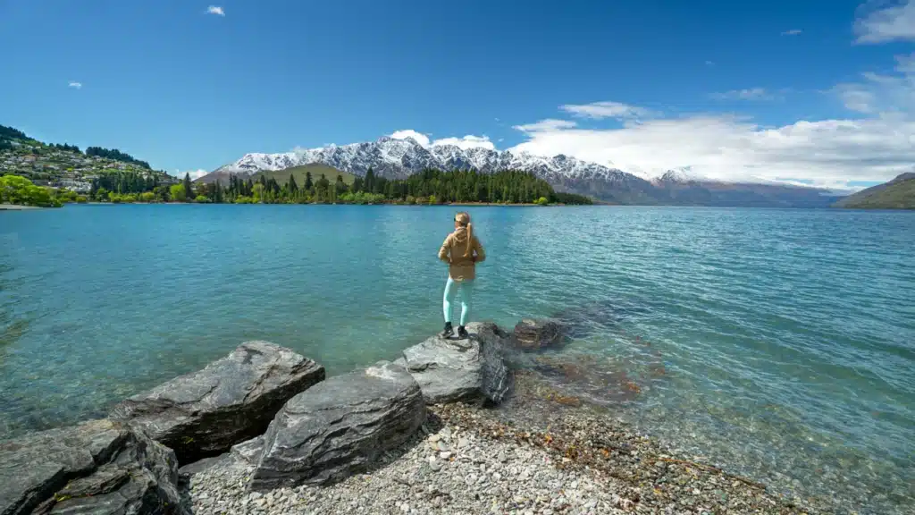
Roys Peak Track
Roys Peak is one of the most famous hikes in New Zealand and a must-do. With stunning views over Lake Wanaka and the snow-capped peaks of Mount Aspiring National Park, Roys Peak will be etched in your memory. It’s a bucket list experience for many travelers coming to New Zealand.
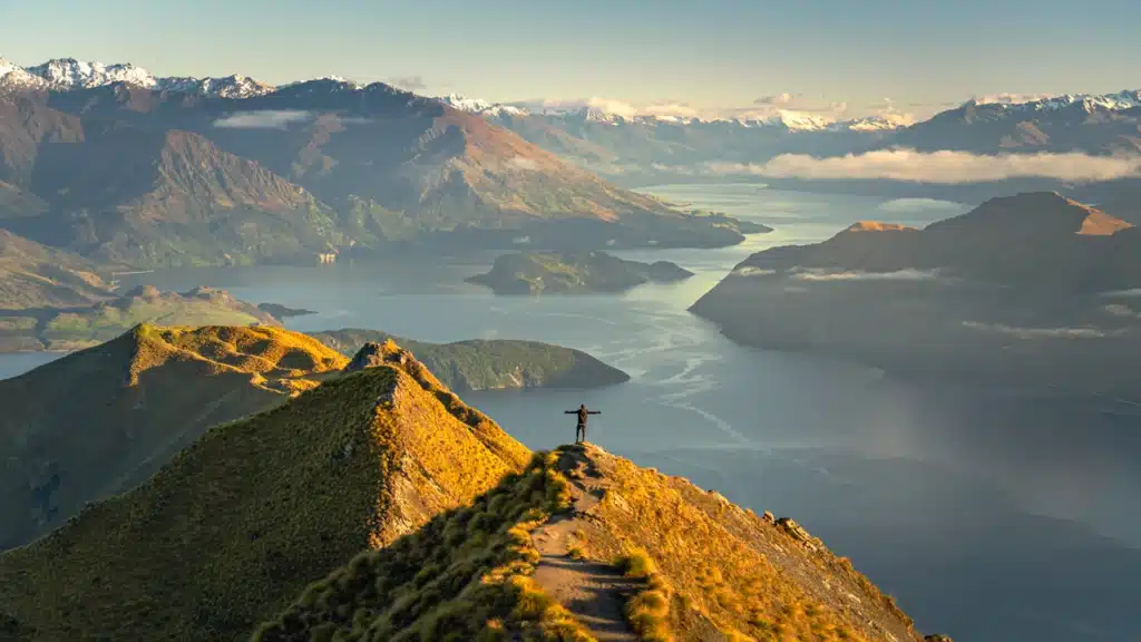
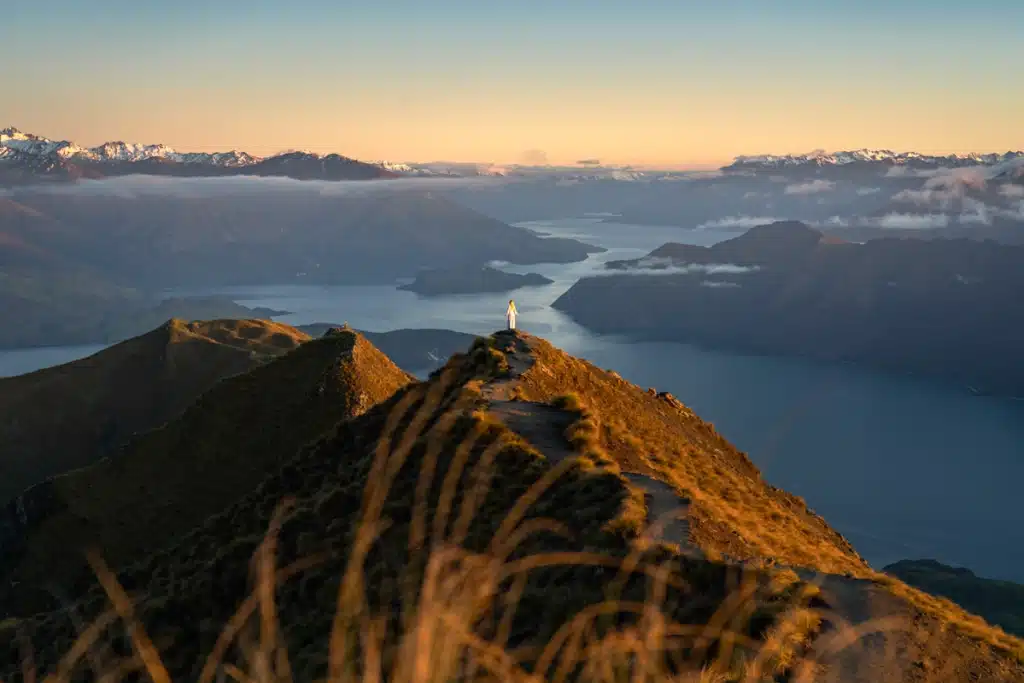
Although it can be crowded along Roys Peak track because of its popularity, there are options to beat the crowds. But you’ll have to be early. Hiking Roys Peak before sunrise is a magical experience to see the first light peaking over the mountains. But with 8 kilometers and 1,258 (4,127 feet) meters elevation one way, you can expect Roys Peak hike to be hard. Nevertheless, it is one of the must-do hikes on the South Island of New Zealand.
Roys Peak hike time and distance: The total distance of Roys Peak is 16 kilometers out and back which takes around 6 to 7 hours to finish. Depending on how long you spend at the summit of course and how many breaks you take during the hike.
Roy Peak difficulty and incline: Roy’s Peak is a medium to hard hike. Of course, this totally depends on how experienced you are with hiking. Be prepared for the 1,258 meters (4,127 feet) elevation gain over 8 kilometers. This is definitely not a joke for the legs. You have to be reasonably fit to hike Roys Peak and bring (more than!) enough water. Roy’s peak height is 1578 meters so you will hike most of Mount Roy to get to the summit.
Read in our complete guide everything about Roys Peak Track
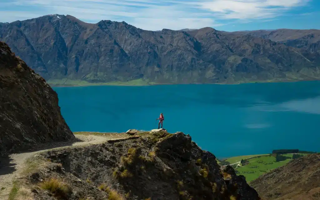
Isthmus Peak Track
Isthmus Peak Track is one of the incredible hikes near Wanaka. With stunning views of Mount Aspiring National Park, Lake Wanaka, and Lake Hawea, the Isthmus peak track is a must-do. And the great thing is, Isthmus Peak isn’t as popular and crowded as Roys Peak. In fact, we were the only ones at the summit when hiking Isthmus Peak for sunrise!
The trail is easy to follow and has a well-maintained wide gravel path. But with 16 kilometers out and back and 1250 meters vertical incline you will have to put in some effort to get to the summit! It’s definitely not one of the easier hikes on the South Island of New Zealand, but worth the effort! And if you like a less crowded hike, then this is the one for you.
Isthmus peak distance and duration: Isthmus peak track is 16 km (9.9 miles) out and back and takes about 6-7 hours to complete. You will walk the same way back as you came.
Isthmus peak difficulty and incline: The total elevation gain is 1250 meters (4,100 feet) over 8 kilometers which is quite the climb. Therefore I would say the Isthmus peak track is difficult, however, the well-maintained gravel path is easy to follow and clearly signed. If you are used to hiking and incline you might say it’s a moderate hike. But it’s definitely not a walk in the park, especially on a hot, sunny day as there is almost no shade along the path.
Read in our complete guide everything about Isthmus Peak Track
Brewster Hut Track
Brewster Hut hike is a brew-tal hike in Mount Aspiring National Park. This beautiful but very steep track through native beech forest brings you to breathtaking mountain views at the summit. Despite the short 2.8 kilometers one way, you will gain almost 1000 meters of incline along the trail. As you can imagine, hiking Brewster Hut is a grueling uphill climb. But you will be rewarded with an incredible view of Brewster Glacier, the Southern Alps, and the lovely red backcountry hut.

You can either do the Brewster Hut track as a day hike or stay overnight in the Brewster Hut. If you have the time, then staying overnight is a must-do as you can then easily extend your hike to one of the most accessible glaciers in New Zealand, Brewster Glacier. Grab your hiking poles, lace up your hiking shoes, and get ready for this epic hike in Mount Aspiring National Park!


Brewster Hut hike distance and duration: The return distance to Brewster Hut is 5.9 kilometers and will take you anywhere between 5 – 7 hours to complete. Average to fit hikers will take about 1,5 – 2 hours to climb in the forest through tree roots and another 40 minutes to reach the hut.

Brewster Hut hike difficulty and incline: In one word, Brewster Track is brew-tal! First, you need to cross the Haast River, and after that, it’s straight up through the forest without a proper flat part until you reach the hut. Therefore I would highly recommend bringing your hiking poles for extra support. The total elevation gain until Brewster Hut is 965 meters. But because you gain this elevation over such a short distance, it literally feels as if you’re vertically climbing up a mountain.
Read in our complete guide everything about Brewster Hut Track

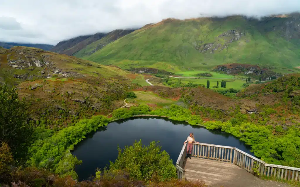
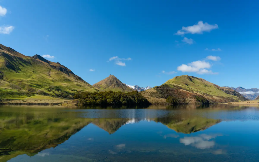
Diamond Lake Track
Diamond Lake Walk and Rocky Mountain Summit Track are two separate hiking trails near Wanaka that can be easily combined into one 7.1-km loop trail. The Diamond Lake track is a relatively easy 1.5-hour return walk that takes you through native bushland to a lookout point over picturesque Diamond Lake.
The Rocky Mountain track on the other hand is a bit more challenging 3-4 hour return walk that takes you up to the summit of Rocky Mountain at 775 meters height. With stunning views over Lake Wanaka and the peaks of Mount Aspiring National Park, this is one of the best short walks near Wanaka.
Read in our complete guide everything about the Diamond Lake and Rocky Mountain track
Queenstown
Queenstown is situated in the heart of the Southern Alps and is surrounded by several amazing hiking trails. The diverse range of hiking trails in and around Queenstown are suitable for all levels of hikers. Whether you’re looking for short nature walks, day hikes, or multi-day treks, there are plenty go awesome hikes in Queenstown to choose from.
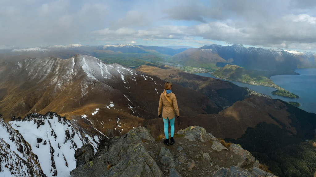
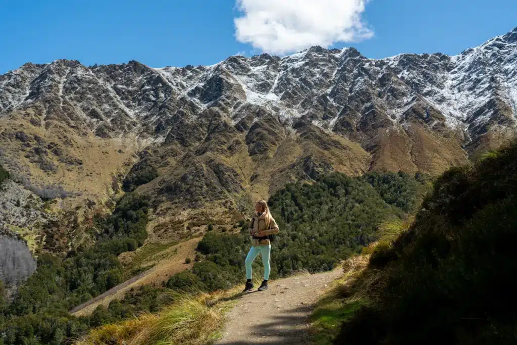
Ben Lomond Track
The Ben Lomond track is without a doubt the best day hike in Queenstown! Easily accessible from the town’s center, you can hike all the way to Ben Lomond summit which is 1,748 meters high. With breathtaking views all along the hike and an epic 360 view at the top, we highly recommend Ben Lomond track over Queenstown Hill walk. However, the out-and-back Ben Lomond track is much heavier with an elevation gain of 1438 meters over 14 kilometers. But, there are several ways to hike Ben Lomond that can wipe 3 kilometers off the trail distance and almost 450 meters off of the elevation. So the question really is how long or short do you want to hike?
Hike distance and duration: If you start the Ben Lomond Track from Queenstown centre you will head up to Bob’s Peak first via the Tiki trail. This version is 14 kilometers (8.7 miles) long out and back and will take about 8 hours in total. If you choose to start the hike from Bob’s Peak and take the gondola up, the total distance is 11 kilometers (6.8 miles) return and will take you about 6 hours in total.
Difficulty and incline: How difficult or easy a hike feels is quite personal, it all depends on what your experience is and how fit you are at that moment. Overall, I think the Ben Lomond Track can be classified as moderate with some technical parts towards the summit. When you add the Tiki trail to your Ben Lomond hike, the total elevation gain is 1,483 meters (4,865 feet). When you start hiking Ben Lomond from the trailhead at Bob’s Peak after taking the gondola up, the total elevation gain is 1,033 meters (3,389 feet).
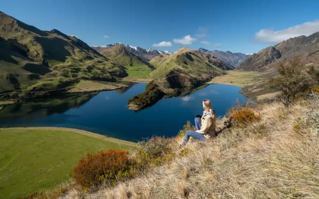
Moke Lake Track and viewpoint
Moke Lake is a picturesque lake surrounded by the tussock-covered peaks of Ben Lomond, Ben More, and Mt Hanley with freshwater wetlands and farmland in the valley. On calm days, the surface of Moke Lake turns into a mirror reflecting all surrounding peaks. It truly is a photographer’s dream with the crystal clear water and breathtaking surroundings. Therefore Moke Lake is one of the best Queenstown photography spots.
But besides taking in and photographing the beauty of Moke Lake, you can also do the 6.5-kilometer (4-mile) long Moke Lake loop track that follows the lake’s edge. This easy trail circles around the lake with stunning views of the surrounding mountains.
If you don’t want to do the loop trail you can also hike straight up to Moke Lake Viewpoint which gives a great vantage point of the lake. If you’re a more advanced hiker then you can continue hiking up this mountain until Williamson Spur at 1100m. The pictures we took which you see here were taken at 800m.
Hike distance and duration: The Moke Lake Loop track is an easy hike of 6.9 kilometers (4 miles) long that follows the lake’s edge. Along the trail, you’ll have stunning views of the surrounding mountains and you can see the lake from every corner. The trail is well maintained and only takes around 1,5 to 2 hours to complete at a slow pace.
Difficulty and incline: With only 182 meter incline which means it’s basically a flat walk, the Moke Lake Loop track is easy and a great family-friendly activity.
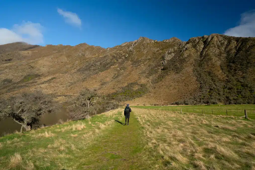
Mount Dewar Track
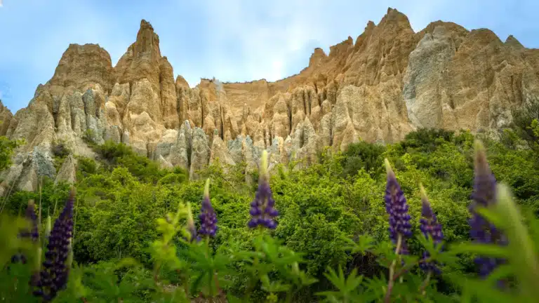
Mount Dewar hike is one of the most underrated hikes on the South Island of New Zealand. Overlooking the golden Skippers Valley and facing west, hiking to the summit of Mt Dewar is great for sunset. The easy 5.2 km return track has a 500-meter incline, so it isn’t too hard. The trail starts at Atleys Track and Devils Creek Track where the Skippers Canyon begins. Although Mount Dewar is not specified on the DOC sign, you won’t miss the summit because there are phone masts. Walk around the antennas and you will the the incredible view of the Golden Skippers Canyon. With layers of dramatic golden ridgelines and the Southern Alps in the far distance, this hike is a fantastic option if you’re looking for a less crowded hike.

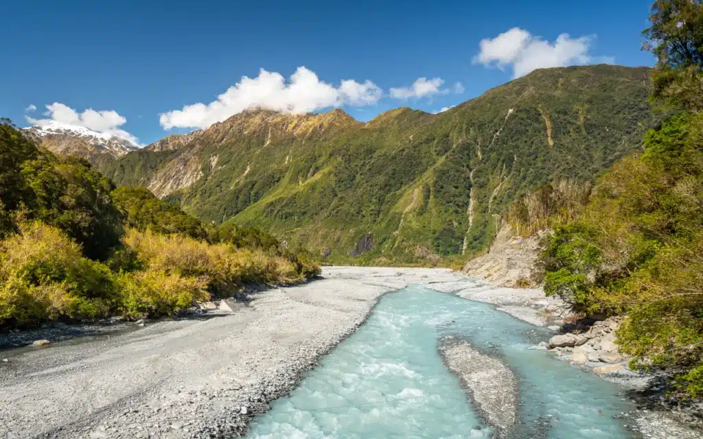
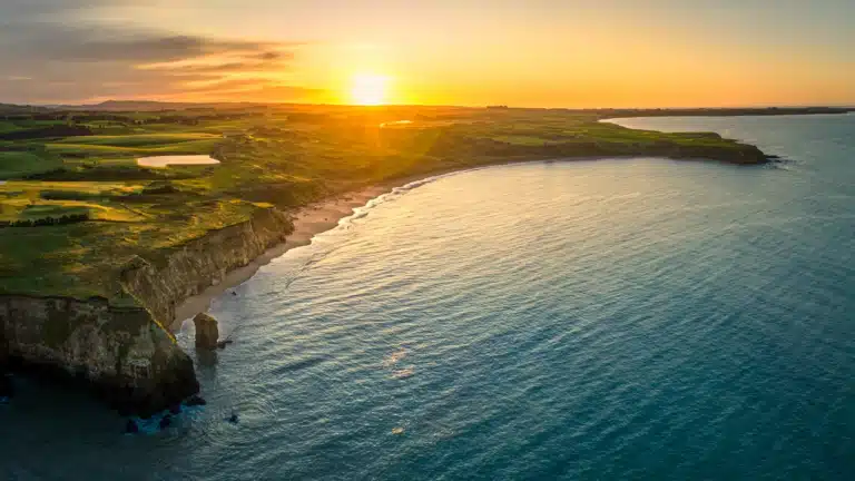
West Coast
The West Coast of New Zealand is renowned for its stunning and diverse natural landscapes. This makes it a great destination for hiking enthusiasts. Characterized by its rugged beauty, dramatic landscapes, and great hiking trails, Franz Josef Glacier Country offers some of the best hikes on the South Island of New Zealand. Get up close with glaciers and explore some of the most beautiful reflection lakes on the South Island.
Roberts Point Track
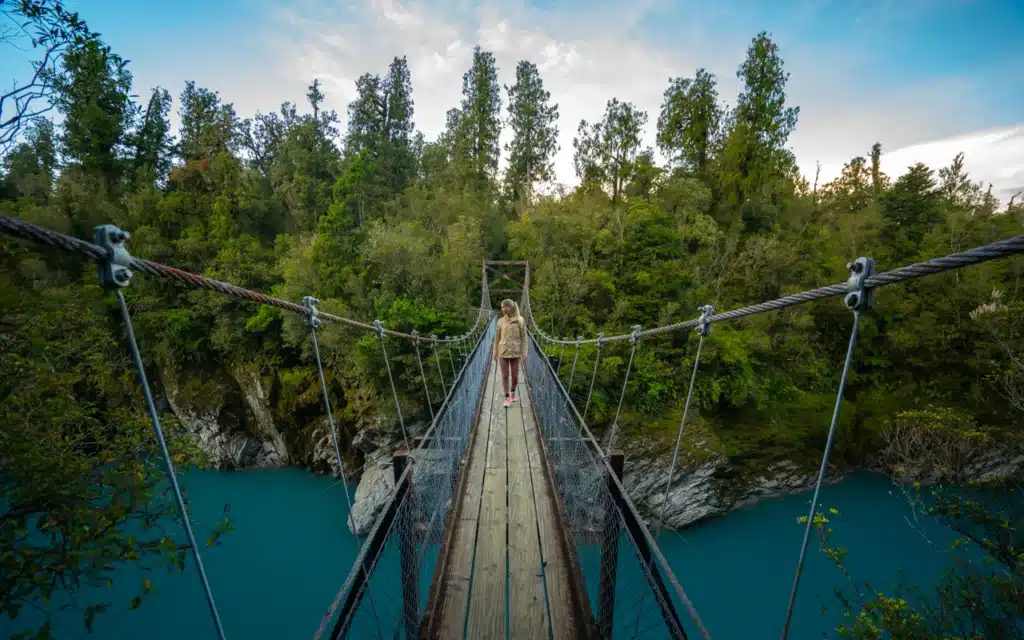
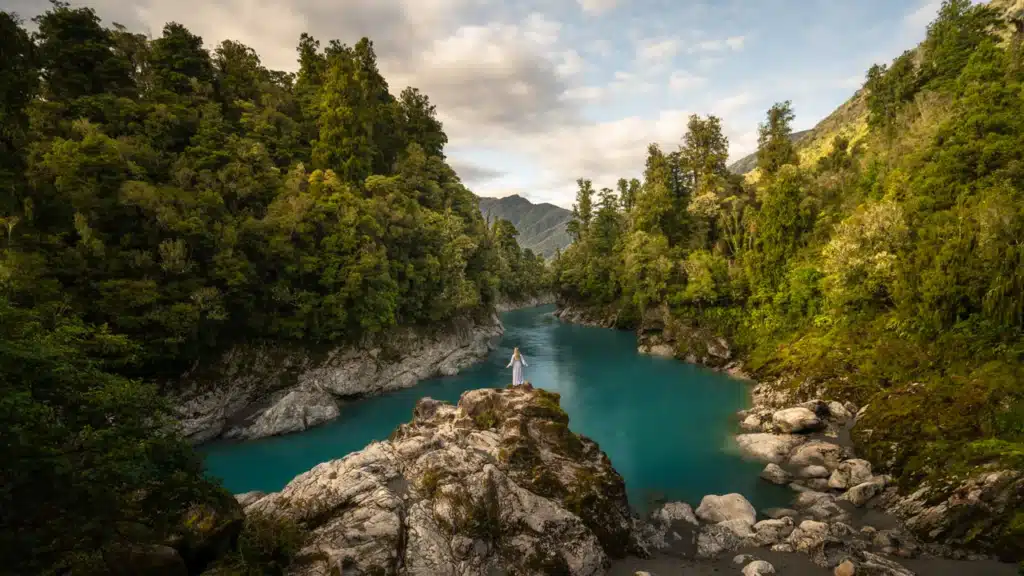
The Roberts Point Track is a challenging hike in Franz Josef that offers stunning views of the Franz Josef Glacier, Waiho River, and the surrounding mountains. The trail is 5.5 kilometers (3.4 miles) one way and takes about 4-5 hours to complete. The Roberts Point track begins at the car park at the end of the Franz Josef Glacier Access Road and follows the Waiho River before ascending through dense rainforest to the viewing platform at Roberts Point. This is the closest you can get to Franz Josef Glacier without opting for the Franz Josef heli hike. The varied hike that takes you along a reflection pond, waterfall, over swing bridges, and through native forest shows you what New Zealand is about.
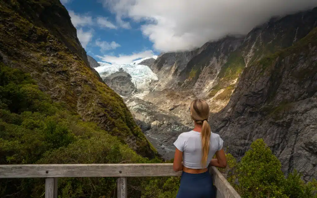
Roberts Point Track distance and duration: The total distance of Roberts Point Track is 11.8 kilometers and takes about 4 to 5 hours to complete.
Roberts Point Track difficulty and incline: Roberts Point Track is considered to be moderately difficult as the terrain is uneven and can be quite slippery at some parts. The total elevation gain of Roberts Point Track is 600 meters (1,970 feet).
Lake Matheson walk
Lake Matheson is a stunning glacier lake reflecting views of the Southern Alps including Aoraki Mount Cook and Mount Tasman. It’s one of the most famous mirror lakes in New Zealand offering breathtaking views. The easy Lake Matheson walk follows a 4.4 km loop trail along the lake’s edge from which you can explore the different perspectives of the lake. This trail is more about the destination than the journey. However, the walk is pretty but not mind-blowing. There are plenty of photo spots with benches along the track to take in the views. If you’re coming for the reflections, I highly recommend going to Lake Matheson early morning. Then you’ll have the highest chance of clear skies and calm weather. Those are the ingredients you need for that perfect reflection shot.

Book your guided Lake Matheson tour
Explore Lake Matheson with a nature guide and enjoy pick up and drop off from your hotel in Franz Josef
This half day tour to Lake Matheson includes a guide, private transportation and pick-up from your hotel in Franz Josef. Limited to a small group, you will be assured of a personal experience. Secure your spot fast before the tour is sold out!
→ Check here prices and availability for this guided Lake Matheson tour incl. transportation
Lake Matheson walk distance and duration: The 4.4-kilometer lakeside loop track is a short but sweet walk in glacier country. It will take about 1.5 hours to complete the circuit around Lake Matheson. You can also only walk to the jetty viewpoint which is 2.4 kilometers from the car park taking only 45 minutes.
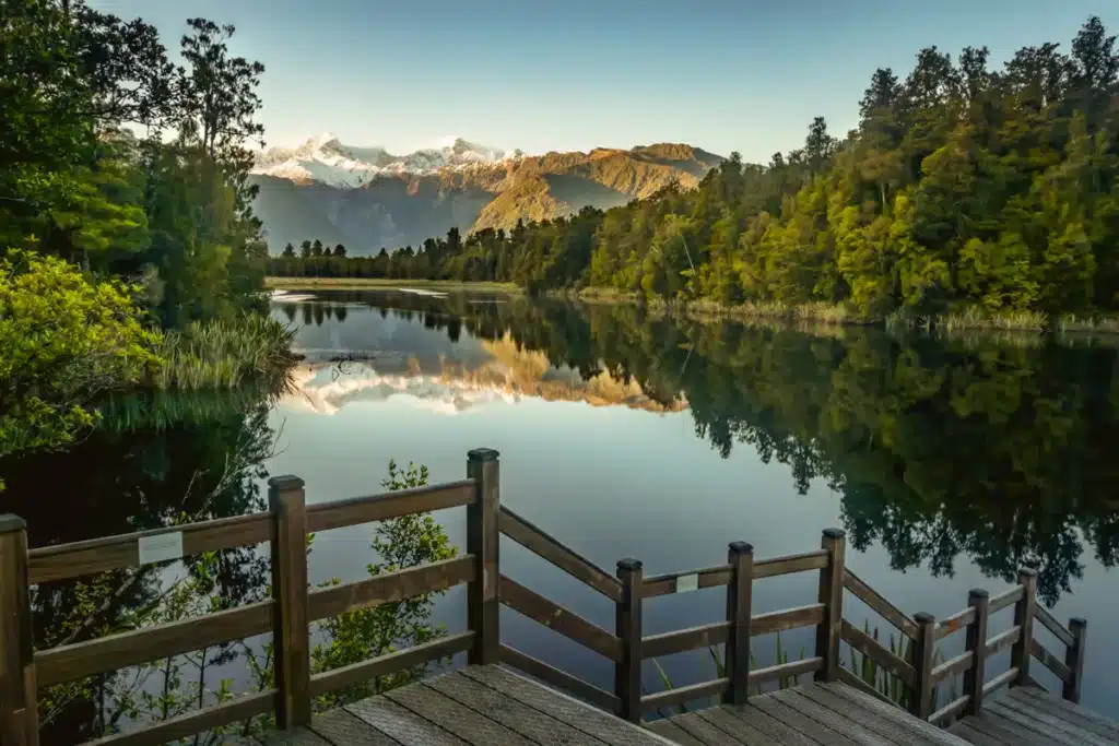
Lake Matheson walk difficulty and incline: With only 133 meters of elevation gain during the Lake Matheson walk there isn’t much difficulty about this trail. The path is very well maintained and even wheelchair friendly until the Jetty viewpoint.
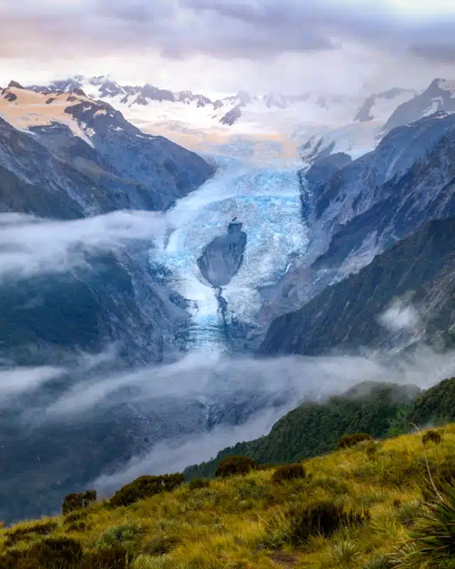
Alex Knob Track
The Alex Knob Track is without a doubt some of the harder walks in Franz Josef. The 17-kilometer out and back trail has an elevation gain of 1,200 meters and is therefore a hard hike. But, the views at the top of Alex Knob Track are breathtaking with unobstructed views of the Franz Josef Glacier. These extraordinary views of one of New Zealand’s Glaciers are otherwise only possible by helicopter tour. So if you’re in for a little hiking adventure and you’re fit enough, then definitely put this one on your list!
Alex Knob Track distance and duration: The 17 km return track takes about 6 – 7 hours depending on how long you spend at the viewpoint.
Alex Knob Track difficulty and incline: The Alex Knob Track is hard with 1200 meters incline of over 17 kilometers. Only do this hike when you are fit and have experience with hiking.
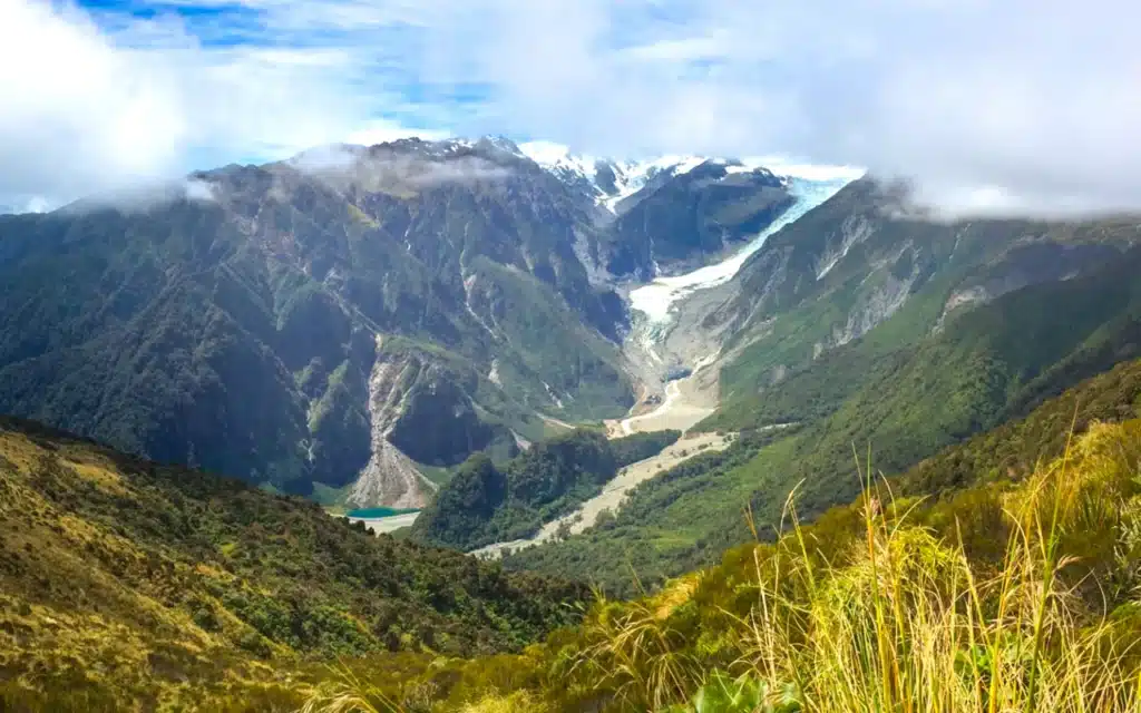
Mount Fox Route
The Mount Fox Route is another one that belongs on the list of hardest walks in Franz Josef. Although it is only a 7.1 km out-and-back trail, the 1,162-meter elevation gain makes it a challenging climb up to Mount Fox. It will take you anywhere between 5 and 6 hours to complete, without the time counted that you have breaks.
Be prepared for steep sections in the overgrown jungle path and parts where you have to climb with your hands. It’s one of those hikes where the reward of the spectacular view at the end makes the amount of suffering worth it. However, you only want to do this hike with clear weather because otherwise it will be hard to spot the glacier. It’s without a doubt some of the best hikes on the South Island of New Zealand. But only accessible to experienced hikers.
Mount Fox Route distance and duration: The 7.1-km out-and-back trail can be completed in 5 – 6 hours depending on how long you spend at the viewing area.
Mount Fox Route difficulty and incline: The Mount Fox Route is considered hard with 1,162 meters of elevation gain over 7 kilometers. Only do this hike when you are fit, have experience with hiking, and when the weather is good.
Hokitika Gorge Walk
The Hokitika Gorge along the West Coast of New Zealand’s South Island is a stunning steep-walled canyon formed by the Hokitika River, which flows through it. The river is known for its vivid turquoise water caused by the suspended rock flour in the water. Surrounded by lush native bush there is a fun and easy walk taking you along the gorge through the pristine podocarp forest of the Hokitika Gorge Scenic Reserve. It’s one of the unique and easy must-do hikes on the South Island of New Zealand.
Hokitika Gorge walk distance and duration: The Hokitika Gorge walk is a 2-kilometer track loop that will take about 1 hour to complete.
Hokitika Gorge walk difficulty and incline: With only 40 meters of incline, the Hokitika Gorge walk is a very easy and well-maintained gravel track. It’s a great family-friendly activity with even a wheelchair-accessible viewing platform.
Summary of the best hikes on the South Island of New Zealand
With all these options of the best hikes on the South Island of New Zealand, you might feel overwhelmed. But depending on your fitness level and interests, you can easily make decisions on which hikes are for you, and which not. Here is a short overview of the 5 best hikes on the South Island New Zealand which are accessible for everyone who is a little fit. These hikes are the most beautiful but aren’t the hardest.
What is the best time to hike South Island New Zealand?
The best time for hiking in New Zealand is generally from spring until autumn which is September until April, or May. It depends on which trails you want to explore and if you want to do the multi-day hikes or day walks.
If you have alpine experience and know how to navigate through snow, then you also can hike during winter in New Zealand. Just make sure to follow the DOC website for avalanche danger reports and rent or buy crampons and an ice axe.
For day hikes either spring, summer or autumn are perfect. All seasons offer something different with the ever-changing landscape. From the flourishing nature in spring to the warm and long summer days or the vibrant colors of autumn. Rain can fall in every season and is something you have to be prepared for.
If you are planning to do the Great Walks in New Zealand then the summer season (December to February) is generally your best option when the weather is more favorable and the daylight hours are longer. However, even in summer there can be rainy days which can impact your multi-day hike. Be well prepared for your New Zealand hiking adventures. Bring different layers of clothing, a rain jacket, and rain pants.
How to get around in New Zealand
To experience New Zealand to the fullest and at your own pace, renting a car, campervan or motorhome is the best way to get around. Which one of these options you choose depends on your preference and budget. If you love camping, being outdoors all day and you don’t mind a smaller living space, then renting a camper van is the way to go. It also gives you the freedom to sleep at some of the most beautiful camping spots and to enjoy most of the best hikes on the South Island of New Zealand. Here’s what you need to know about renting a car, camper van, or motorhome in New Zealand.
Car rental in New Zealand
Renting a car in New Zealand is the easiest and cheapest rental vehicle available. It will get you to all the best destinations with ease and gives you the freedom to stop for a break wherever you want. However, you should keep in mind that some roads in New Zealand are still gravel or that you have to cross shallow rivers to some destinations in National Parks. Therefore we recommend a mini SUV or SUV model to have enough clearance for this kind of roads.
The best place to book your rental car in New Zealand is on Discover Cars where you can compare different car models, prices, companies and terms and conditions. You can also check Rental Cars to compare at which platform you can get the best deal. Make sure to secure the booking of your rental car as soon as possible to have the lowest price possible. Prices go up the closer you get to the pickup date.

Campervan rental in New Zealand
Traveling around in a campervan is one of the most popular ways for a road trip in New Zealand. With a bed, small kitchen and seating area you will have all the (basic) needs on four wheels. Make sure to check if your campervan has a shower or not because this might influence where you want to camp. A campervan allows you to camp at plenty of beautiful places, sometimes for free, sometimes for a fee. It will give you a true feeling of freedom and connect you with nature.
We personally recommend to book your campervan with Travellers Autobarn. They have a wide range of Station wagons, 2-berth campervans & 3-5 berth campervans to hire for all budgets. All Travellers Autobarn campervan hires in New Zealand come with free unlimited kilometers, 10% discount to premium campgrounds, 24/7 roadside assistance & long-term rental discounts. Check the availability and prices today to secure your campervan for a New Zealand dream road trip!

More New Zealand travel guides
I hope you enjoyed this complete guide about the best hikes on South Island New Zealand. We have many more New Zealand travel guides to help you plan your ultimate road trip. Read our other travel blogs to create your own New Zealand South Island itinerary.
South Island New Zealand guides
Queenstown
30 best things to do in Queenstown – The Ultimate Guide
20 best Queenstown restaurants – The Complete Guide
16 best hikes in Queenstown – The Ultimate Guide
Queenstown Hill Walk – The Complete Guide
Ben Lomond track – The Complete Guide
Moke Lake loop track & viewpoint – The Complete Guide
Bobs Cove Nature Walk – The Complete Guide
Wanaka
22 best things to do in Wanaka – The Ultimate Guide
Best places to stay in Wanaka – The Complete Guide
15 best walks in Wanaka – The Complete Guide
Mount Cook National Park
20 best things to do in Mount Cook National Park
Best accommodations in Mount Cook Village
12 best Mt Cook walks – The Ultimate Guide
Hooker Valley Track – The Complete Guide
Sealy Tarns track – The Complete Guide
Tasman Glacier Viewpoint – The Complete Guide
Mueller Hut Track – All You Need to Know
Glenorchy
20 best things to do in Glenorchy – The Ultimate Guide
Glenorchy walkway & lagoon track – The Complete Guide
Earnslaw Burn glacier valley and waterfalls – The Complete Guide
Fiordland National Park
20 best things to do in Milford Sound – The Ultimate Guide
Lake Marian Track – The Complete Guide
Milford Sound Cruise – The Complete Guide
Key Summit track – The Complete Guide
Gertrude Saddle Track – The Complete Guide
Franz Josef Glacier Country
Best Franz Josef heli hike tours – All You Need to Know
15 best walks in Franz Josef – The Ultimate Guide
Lake Matheson Walk – The Complete Guide
Franz Josef Glacier Walk – The Complete Guide
Roberts Point Track – All You Need to Know


This post may contain affiliate links
We hope this guide will help you plan your travels! If you consider booking your accommodation, tours or rental car via our affiliate links, you support this blog because we earn a small commission at no additional cost to you!